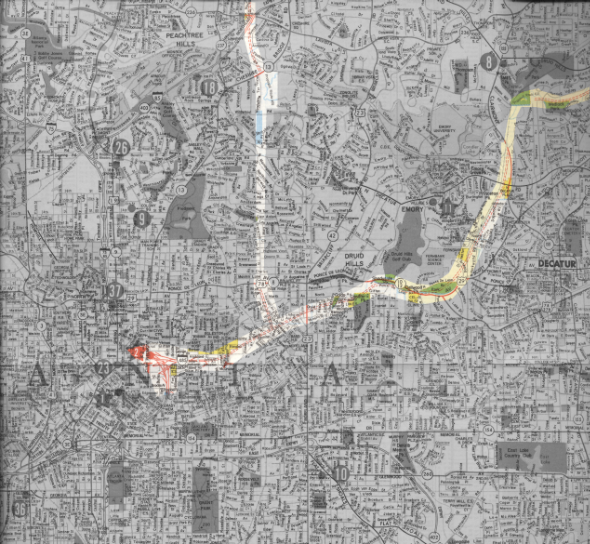
Sorting through some of my Mom’s old paperwork this weekend, I found a streetmap of Atlanta. There’s no copyright date, but I think it’s from the late 1970s. Of course, I looked up my own neighborhood… which actually hasn’t changed much. But then I noticed an Interstate highway shield for I-485.
Here’s a reduced version to fit on your screen, but you can click on the image to see it 5000 pixels wide.
(If you want the full-color, full-size original without the shading, click here.)
Wow! Look at the proposed routes for I-485 and Georgia 400! That would have gutted big chunks of Midtown, Virginia-Highland, Morningside, Little Five Points, and Decatur! (On the other hand, I guess it’d finally be possible to drive to Emory without a full tank of gas, emergency rations, and a native guide.)
I remember some of the controversy about “Presidential Parkway” from when I was a kid, but this triggered me to look it up on Wikipedia. Neighborhood activists stopped the Georgia Department of Transportation from building these roads, but some of the right-of-way had already been acquired. That’s where Freedom Parkway, Freedom Park, and the Carter Center came from.
I suppose traffic would have flowed more smoothly, but I’m glad this is one of the first times (maybe THE first time?) that Atlanta neighborhoods said “Enough!”

[…] I-485 […]